Current Projects
Semi-Automated Image Annotation Tool
Guide - Dr. Sivakumar Rathinam
- Integrated Spatial-CNN with image annotation tool to generate lane line predictions for all frames in video
- Retrained the VGG + SCNN model on own dataset annotation using the tool built
- Identified lane attributes such as color and type automatically to reduce repetitive work
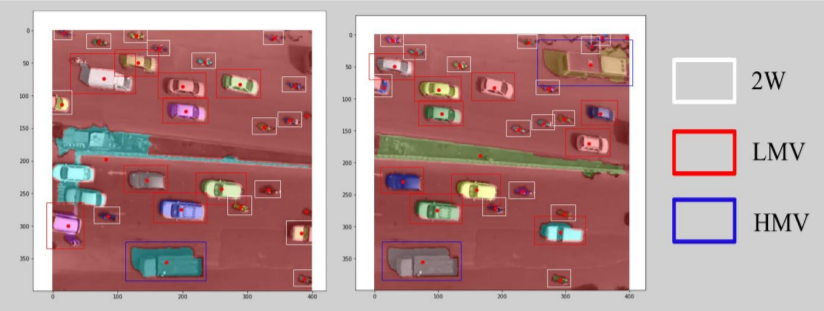
Vehicle Trajectory Data Collection Using Aerial Videography
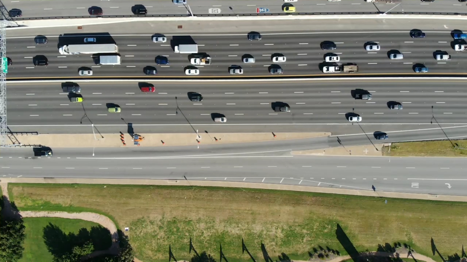
- Proposed a novel architecture to collect vehicle trajectory data for an extended period on freeways and arterials
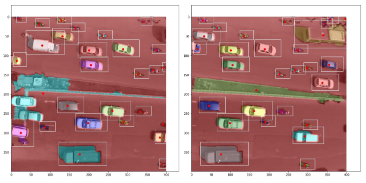
- Preparing High Definition(HD) dataset for traffic data analysis and vehicle detection applications.

Previous Projects
Examining cost aspects of shared autonomous vehicles as MaaS
Guide - Dr. Mark Burris
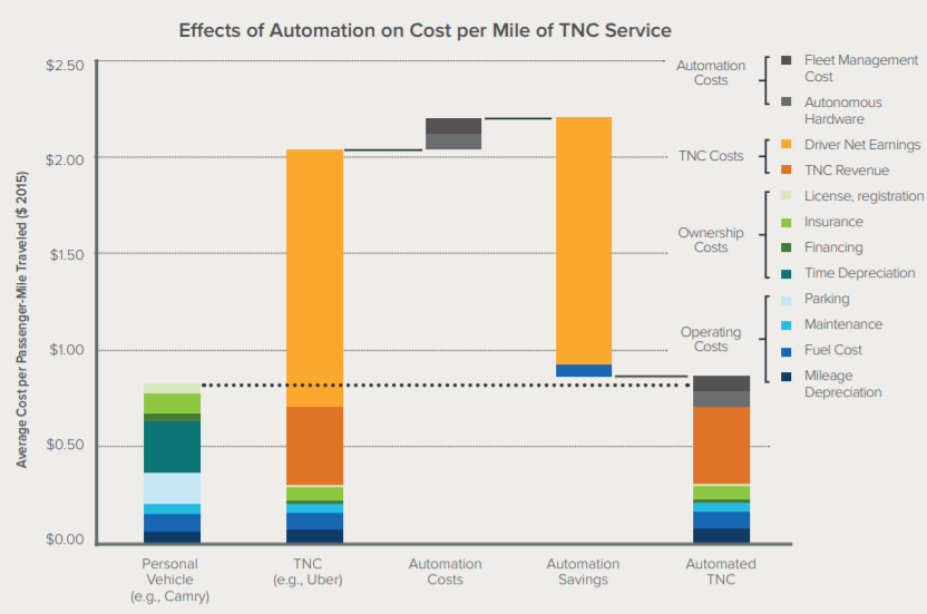
- Ride-sharing services are becoming increasingly popular, are affecting people’s choice to use cars as a service rather than owning personal vehicles. The study focus is to see if such a system is plausible considering cost aspects.
- Generated Origin-Destination matrix for Austin city using ArcGIS and integrated it with a grid-based network
- Developed an autonomous ride-sharing simulation with dynamic trip generation and allocation scheme algorithms
- Evaluated the pricing scheme for MaaS to compete with vehicle ownership and other ride-sharing services
- Accepted for presentation at Transportation Research Board (TRB) 2020 and in review for publication
Response of Autonomous Vehicles to Emergency Vehicles (RAVEV)
Guide - Dr. Sivakumar Rathinam
- Prepared image and sound datasets for emergency vehicles, and trained a NN classifier using Keras
- Integrated detection algorithms with path planning and controls using Robot Operating System (ROS)
- Conducted experiments on high-speed autonomous vehicle (up to 70 mph) to avoid obstacles, and respond to emergency vehicles (EV) in real-time
- Presented research poster at Spring TexITE meeting - 2019, San Antonio, Texas
Image Processing Techniques for Traffic Data Extraction from Aerial Imagery
Guide – Dr. Lelitha Devi, Co-Guide – Dr. Bhargava Rama Chilukuri
- Presented research paper at UMI Symposium – 2017, Hyderabad, India
- Compared image processing algorithms on a drone-based video in an Indian Scenario
- Otsu thresholding, edge detection, and morphological operations were implemented for counting
- Support vector machine was used for classification of vehicles into LMV, HMV, and TW
Automation of Glass Fragmentation Testing
Guide – Dr. Arul Jayachandran
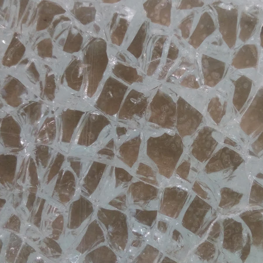
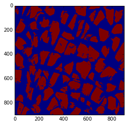
- Automated the process of Glass Fragmentation Testing that involves tedious manual counting by using Image processing techniques
- Built a prototype with GUI using raspberry pi and pi camera modules
Course & Other Projects
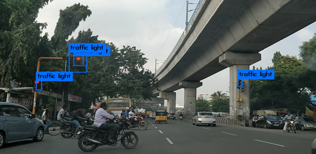
Traffic Signal Detection Using Image Processing
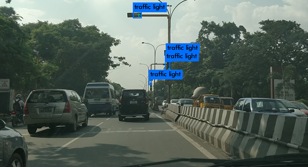
- Detected traffic signal using background subtraction, color thresholding and shape filters
- Used CNN based architecture YOLO for better detecting signals in Indian scenario
- COCO dataset was used for pretrained weights for signals. The dataset was augmented using signals in Indian scenario and transfer learning was used to retrain the weights
Solving Maze Puzzle Using Image Processing
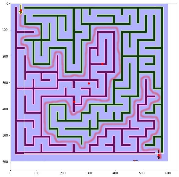
- Since childhood, I was interested in solving puzzles, especially the maze puzzles. It so struck me one day that I could solve this puzzle using skills I have
- The idea was to split the image into portions that were disjoint(have no connection). I tried various morphological techniques using the OpenCV library and graph search algorithms to solve. A sample result is displayed here in which the maze is split into two portions(green and dark pink).
- P.S It only works for certain set of maze puzzles.
